Shallow reef ecosystems are constantly changing. Some changes occur naturally for a multitude of reasons, while other changes are directional and related to particular anthropogenic pressures. A biodiversity indicator is a metric that indicates directional change related to a particular pressure (e.g., ocean warming), such that a management response can be identified.
In practice, however, managers and the public are often also interested in general ecological metrics that summarise important biodiversity values. These are often mixed into the bucket of metrics loosely referred to as ‘indicators’, with the shared purpose of distilling complex multivariate biodiversity data into univariate measures. They may be used for a variety of purposes, including data exploration, hypothesis development or evaluation or, as in the case of the Reef Life Explorer, as a tool for communication.
RLS monitoring data allow the calculation of many biodiversity metrics for reefs, including sensitive indicators of directional change and more general biodiversity values. Scientists associated with the RLS and Australian Temperate Reef Collaboration monitoring programs have been studying reef biodiversity change for decades, with an extraordinary database of reef biodiversity datum available to look into the responses of reef ecological communities to pressures and environmental gradients, and to test indicators for sensitivity and specificity.
This page outlines the rationale, calculation methods and key considerations for interpretation of some of the indicators developed and/or used for reporting on reef change through RLS (and the ATRC), including those displayed on the Reef Life Explorer or in RLS management reports.
Many of the indicators listed on this page rely on quantitative standardised data collected on all species possible to survey on a reef (not a subset of those present on a given reef) from multiple taxonomic groups, as well as species-specific information (e.g., size range, thermal affinity etc.). To allow for direct comparisons through space and time, most indicators should be calculated at the surveyID level first (i.e. per 50 m transect). These values are often averaged amongst surveys at a site in a given year of monitoring, but it is up to the data analyst to choose the right analyses for the structure of the data they are analysing and questions they wish to address. Frequency-of-occurrence-based indicators are not calculated at the surveyID level, but for a broader collection of surveys and sites within a monitoring location.
This indicator is simply the biomass of fishes recorded on surveys that are in the 20 cm size class or larger (often referred to as ‘B20’)(Stuart-Smith et al. 2017a). It is designed to track changes in reef fish stocks of greatest importance to recreational, commercial and subsistence fisheries. The idea is that increasing exploitation typically removes larger fishes first, causing the indicator to decline. Increasing stocks and potential value for humans and biodiversity are indicated by high values.
The biomass of fishes 40+ cm (B40) and 50+ cm (B50) are calculated in an identical fashion, simply by filtering by a higher length category.
Natural gradients in fish biomass exist, so when comparing this indicator between locations its important to consider other drivers of biomass (e.g. temperature, primary productivity and habitat complexity).
This indicator has been tested and found to be more specific to fishing pressure than other indicators used for this purpose, but it should still not be considered specific to that pressure only. Changes in the Large Reef Fish Index through time can also occur as a result of changing sea temperatures and productivity, but strong local trends in this indicator through time which do not appear to be regionally consistent or match indicators of ocean climate change, provide evidence to suggest changing fishing pressure may be responsible.
The sum of biomass values (in kg per 500m2) of all fishes within a surveyID that are in the 20cm size class or higher. This requires using only data from method 1, filtered for classes = Actinopterygii, and summing across blocks and size classes.
This indicator, commonly referred to as the Community Temperature Index (CTI), is a community weighted mean of the thermal affinity for each fish species recorded on a survey.
The idea is that as sea temperature changes, the community of fishes readily reshuffles according to which species are favoured or disadvantaged by the change. Often warmer-affinity species arrive, sometimes cooler affinity species are extirpated and species may change in abundance as they either approach or depart from their optimal temperatures (Day et al. 2018, Burrows et al. 2019, Waldock et al. 2019).
The thermal affinity of each species can be considered in a number of different ways, with the mid-point of the thermal range of the species most often used with the RLS data; thermal range defined as the 5th percentile of annual minimum sea temperatures at sites occupied by the species and the 95th percentile of the annual maximum sea temperatures of sites occupied (Stuart-Smith et al. 2017b).
Using the CTI terminology, the thermal affinity measure can be considered the ‘STI’ (Species Temperature Index), as referred to in the calculation below.
This indicator theoretically increases as temperatures rise and vice versa. Spatial variations in the indicator are often non-linear, as the communities in a given region are usually highly similar, and a large step in values occurs as temperate communities give way to tropical, for example (Stuart-Smith et al. 2015). This indicator is most powerful for tracking change through time, and especially in locations that are well connected to sources of fish larvae from other regions. Change is influenced by the thermal composition of the community (Burrows et al. 2019). It appears least sensitive in isolated tropical locations where recruitment dynamics can be decoupled from temperature, and may also be confounded by concurrent habitat-driven community change (e.g. when heatwaves cause coral bleaching).
Filter data to include only method 1, and classes = Actinopterygii & Elasmobranchii. Join the STI values to species names and remove NA rows for which no STI values are available.
The total abundance of each species within each surveyID is transformed using Log10(N+1). Create a new column (called LogN here). Logging is done to avoid domination of the index by the one or two most abundant species and allow rare species to contribute, and the 1 is added to ensure no zero values are present after logging.
For each surveyID (e.g. using ‘group_by’ in R), multiply the logged total abundance of the species on the survey by it’s STI, creating a new variable (called LogN_STI here)
Sum values of LogN_STI and values of LogN for each (e.g. using the ‘summarise’ function in R), and then divide the former by the latter – this is the CTI for the surveyID.
An alternative is to use the ‘CWM’ function within the ‘summarise’ function in R, using mean STI as the trait and LogN as the weighting variable.
It is important to ensure no zero values or NAs exist in either LogN or STI columns, as this will result in miscalculation.
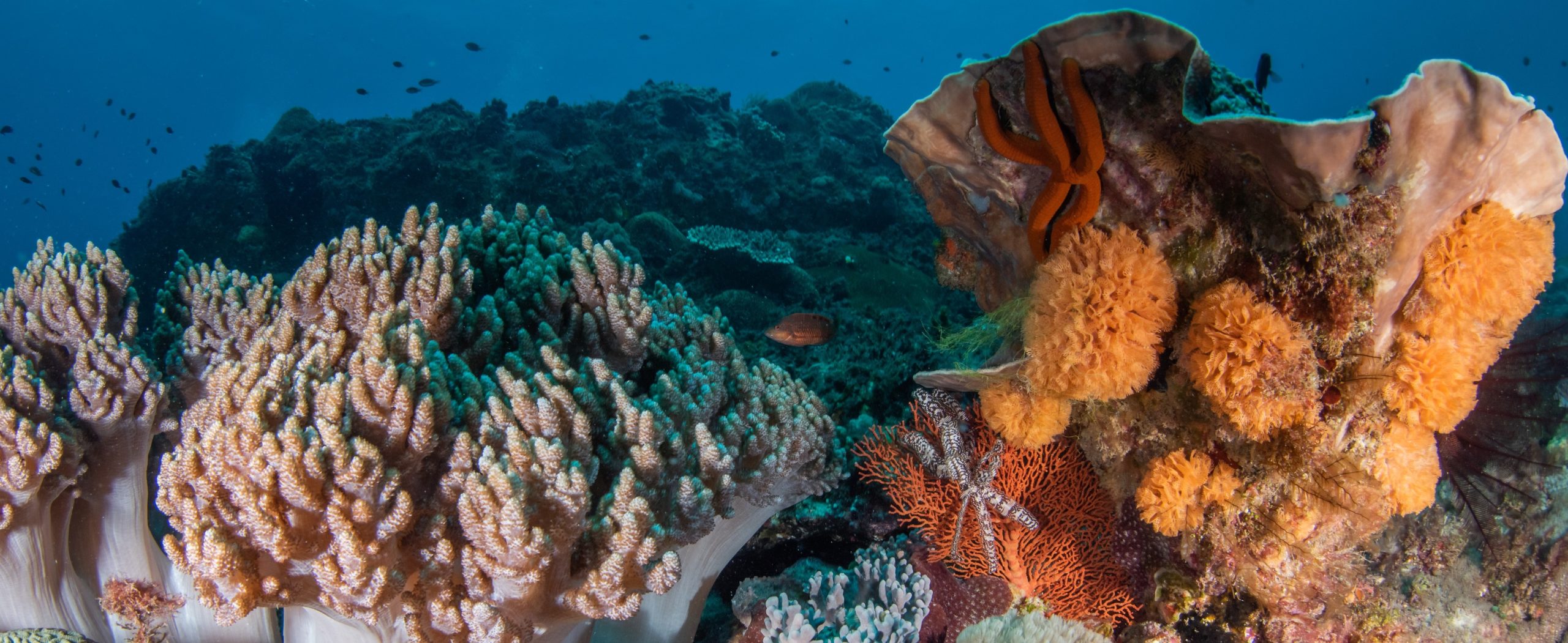
Like habitat cover, the richness of species is not considered a ‘true’ indicator by many definitions but is more a natural value of human interest and ecological importance. It provides an easy to interpret indication of the diversity of life present, and in this case is split up into three different groups of animals; Fish (all fishes), Cryptic Fish (just those fishes that are considered cryptic and require special surveys), and Invertebrates (mobile, macro-invertebrates).
For most marine life, species richness varies strongly along spatial and environmental gradients (Edgar et al. 2017), so focus should instead be given to changes in richness through time. The identities of species gained or lost from a system are likely to be important to understanding why a given trend is occurring.
For fishes, filter for method = 1 and classes = Actinopterygii & Elasmobranchii; for cryptic fishes, filter for method = 2 and classes = Actinopterygii & Elasmobranchii; and for invertebrates, filter for method = 2 and classes = Asteroidea, Bivalvia, Cephalopoda,
Crinoidea, Echinoidea, Gastropoda, Holothuroidea, and Malacostraca.
For fishes, simply count the unique species names within each SurveyID for the number of fish species per 500m2.
For cryptic fishes and invertebrates, ‘block’ must be considered, as some surveys only include a single block or method 2 data, and others two. Count the unique species names within each combination of SurveyID and Block (e.g. group_by surveyID and block together in R) for the number of species per 50m2.
Richness is easily miscalculated if not done at the surveyID level before summarising at other spatial or temporal levels of aggregation, being very sensitive to survey effort. Thus it should always be calculated at the individual block level for data from method 2 and either at surveyID or block level for method 1 data. Combining data from method 1 and 2 (e.g. for a total richness of fishes and inverts) requires special treatment and calculations, with additional caveats – contact RLS if needing special guidance.
Many species of sea urchins can overgraze seaweed habitats and modify the whole reef ecosystem (Ling et al. 2009). This is a simple indicator of this potential, measured by the number of sea urchins scored on reef surveys.
Higher numbers of urchins indicate that seaweed habitats may already be impacted, and rising numbers flag the risk of habitat degradation. Often higher urchin numbers are needed to initially create a barren, then lower numbers can maintain the reef in that state, so intermediate numbers could reflect a reef in either state. Not all sea urchin species present the same risk of barrens forming, and different sized individuals and species mean that thresholds can be different (and usually depend more on biomass of urchins). So further investigation is needed if this indicator suggests increased or decreased risk of habitat degradation.
Filter for method = 2 and exclude genus = Echinometra. Sum the abundance of all rows with class = Echinoidea.
Sharks and rays are exploited in most parts of the world, and have ‘slow’ life histories, producing few young rather than hundreds to 100's of 1000's of eggs as is the case for bony fishes. Their presence on reef surveys is thus one indicator of the local pressure from exploitation (legal or illegal).
Changes through time indicate losses of important elements of biodiversity most likely related to exploitation. Some regional differences exist, however, and must be accounted for when comparing trends through space. Despite this, heavily exploited regions around the world tend to have lower values. Note that counts of larger mobile sharks are not reliable estimates of their true density on reefs, as many species actively avoid or are attracted to the divers undertaking the surveys. All values from visual census data on fishes should be considered relative, rather than absolute, but this is especially true for sharks. It is likely to be comparable through space and time but does not accurately reflect the number of sharks on a given reef.
Filter for method = 1 and class = Elasmobranchii. Sum the abundance within each surveyID.
This refers to the cover of either large canopy-forming macroalgal kelps or live hard corals, as scored from quadrats (either photoquadrats or scored by divers underwater). The cover of large seaweeds (in temperate areas) or corals (in tropical areas) is perhaps the first thing most people notice when swimming over a reef, and is an important component of the habitat available to the animals that live on the reef. Generally speaking, large canopy-forming seaweeds, such as laminarian and fucoid algae, are considered desirable in temperate regions, while living hard corals are the desired condition on tropical reefs. Macroalgal cover and Coral Cover are also classified as Essential Ocean Variables by the Global Biodiversity Observation System, and form key metrics for global reporting on the condition of shallow reefs.
This is a relatively ‘coarse’ indicator from an ecological perspective, and may respond to numerous pressures and in complex and varied ways. Higher values and increases are generally considered good, but it is critical to keep in mind that changes in the composition of coral or algal taxa can occur but are not captured by this indicator. E.g., coral cover could remain stable through loss of tabular and branching corals and replacement by encrusting hard corals. More research is needed to determine the most ecologically informative subsets of coral and kelp groups to base this indicator on.
The sum of cover is scored for each surveyID among the following categories:
Regional Reef Health scores are calculated for a few indicators that are considered to be relatively comparable through space (i.e. unlikely to be strongly shaped by biogeography) and that provide some indication of the general state of the reef (in terms of human impacts).
Health scores are a coarse way of making comparisons among regions based on spatial data only, and are naive to temporal change at each location. Ideally, conclusions on health of regions would be based on trends through time as well as spatial context. Care is therefore needed for interpretation of these health scores, and it is not recommended that strong conclusions on reef health be based on these health scores alone.
Regional Reef Health scores are also influenced to some degree by the number of surveys undertaken in a given province [region], with the odds of a site being in the top 25% worldwide smaller when very few sites have been surveyed.
Calculated as the proportion of surveys in a given Marine Province (as defined by (Spalding et al. 2007)) which are in the top 25% of all surveys worldwide for that indicator. So if 50 sites have been surveyed and 25 of them are in the top 25% worldwide, the health score (50%) shows that the sites surveyed in the province have more high-value sites than expected based on the global average (which is 25% by definition).
Local management agencies often wish to track indicators of local relevance, such as species that are key targets for local reef fisheries or listed as threatened. Some of these are well covered by the visual census methods used in RLS and ATRC, and their abundance/ biomass on surveys can be used to evaluate trends.
Survey data may not be sufficient for tracking other species that are less well covered by the survey methods, due to rarity, alternative habitat or depth preferences, or mobile or shy nature, for example (e.g. yellowtail kingfish (Seriola lalandi) or Western Australian Dhufish (Glaucosoma hebraicum)). For such species, the frequency of occurrence is generally a more powerful way of analysing trends than the abundance or biomass on transects, and the more surveys, greater area of investigation or greater time-series with which to evaluate frequency of occurrence, the better the chances of detecting trends.
RLS works with local management agencies to identify species that can be more consistently covered by method 0 through the future, which can then be used to help track frequency of occurrence.
Increases or decreases in frequency of occurrence can be very informative for identifying trends not well covered by any survey means or which are rare in the seascape. These do not necessarily translate to abundance changes and should be used to instigate further targeted study or evaluation.
The proportion of sites among any defined group of sites at which the species has been recorded. The group of sites should be consistent for temporal comparisons.
All marine protected areas displayed on the MPA time-series layer include protection level data drawn from ProtectedSeas (as of October 2025). This data provides a protection level for all MPA zones according to degree with which fishing activities are restricted, ranging from 1 (no known restrictions on fishing beyond background national regulations) to 5 (fishing prohibited, i.e., no-take).
These values are standardised across all MPAs globally, allowing users to directly compare both the degree of fishing protection across Australian and global MPAs, as well as the response of the reef communities to this protection.